Google Maps will send you to Loop 360. Every guide you find online lists the access points in the same east-to-west order, gives you addresses, and says “have fun.”
Not exactly helpful when you’re standing in a shared office parking lot off a highway, wondering if this is even the right place.
I’ve hiked every trailhead on this trail more times than I can count, and I’ve placed plenty of renters that specifically want to be within walking distance of the trail heads along each of these corridors: Barton Hills, South Lamar, Zilker, Westlake. The Greenbelt is one of the top reasons people want to live in south-central Austin, and it’s one of the first things I bring up when someone tells me they want to be close to outdoor stuff.
But here’s what most guides get wrong: they treat all 7 access points like they’re interchangeable. They’re not. Some drop you onto flat, shaded paths where you can push a stroller. Others send you down a 300-foot rocky descent that’ll wreck your knees if you’re not ready for it. Some have parking lots. Some have you circling a residential street for 20 minutes trying to find out where the trail heart begins and where to park.
This guide breaks down each access point honestly: parking reality, trail difficulty, what’s actually there. Plus a comparison table, seasonal water conditions, and which apartment neighborhoods sit closest to each trailhead. That last part? Nobody else covers it.
Every Access Point at a Glance
Before I break each one down, here’s the side-by-side comparison nobody else gives you. Bookmark this.
| Access Point | Address | Parking | Restrooms | Difficulty | Best For |
|---|---|---|---|---|---|
| Zilker / Trail Head | 2212 William Barton Dr, 78746 | Lot — free weekdays, $7 weekends (Mar–Sep) | Yes (Zilker Park) | Easy | Casual walks, beginners, dogs |
| Spyglass | 1601 Spyglass Dr, 78746 | Street — free, limited | Composting toilet ~0.07 mi in | Easy–Moderate | Campbell’s Hole, The Flats, limestone tubs |
| Barton Hills / Homedale | 2009 Homedale Dr, 78704 | Lot at school park — free | No | Moderate | Campbell’s Hole (east side), east bank trails |
| Gus Fruh | 2632 Barton Hills Dr, 78704 | Street — free, limited | No | Moderate | Deep swimming hole, rock climbing, rope swings |
| Loop 360 (Main) | 3753 S Capital of TX Hwy, 78704 | Shared lot — free | Composting toilet | Easy–Moderate | Mountain biking, Seismic Wall, central trail hub |
| Twin Falls / Gaines Creek | 3918 S MoPac Frontage Rd, 78746 | Roadside shoulder — free | No | Moderate | Twin Falls, Sculpture Falls |
| Trail’s End / Camp Craft | 1712 Camp Craft Rd, 78746 | Street — paid (8 AM–8 PM) | Composting toilet ~0.05 mi in | Strenuous | Hill of Life, Sculpture Falls (west approach) |
A few things to know about this table. “Best For” is based on what I’ve actually experienced at each trailhead, not what’s on a brochure. Difficulty ratings factor in the walk from your car to the trail itself. Some of these access points have a steep descent before you’re even on the main path. And “Restrooms” means what’s there when you arrive, not what’s a mile down the trail.
Don’t Want to Read All 7? Here’s the Short Version
- Want to swim? Start at Gus Fruh (2632 Barton Hills Dr) for the deepest swimming hole, or Twin Falls/Gaines Creek (3918 S MoPac Frontage Rd) for the waterfalls. Check water levels first.
- Mountain biking? Enter at Loop 360 (3753 S Capital of TX Hwy) for Seismic Wall and the technical terrain, or Trail’s End (1712 Camp Craft Rd) if you want the Hill of Life climb. The best riding is west of Loop 360.
- Rock climbing? Gus Fruh (2632 Barton Hills Dr) puts you closest to Urban Assault and Guide’s Wall. Loop 360 (3753 S Capital of TX Hwy) is your access for Seismic Wall.
- Easy walk or jog with the dog? Zilker/Trail Head (2212 William Barton Dr). Flat path, paved parking lot, restrooms, water fountains.
- Least crowded? Barton Hills/Homedale (2009 Homedale Dr). Most people don’t know about it. Quieter east bank trails and a back route to Campbell’s Hole.
- Waterfalls with the shortest hike? Twin Falls/Gaines Creek (3918 S MoPac Frontage Rd). Twin Falls is 10-15 minutes in. Sculpture Falls is about 1.2 miles total.
- A serious workout? Trail’s End (1712 Camp Craft Rd). The Hill of Life drops 300 feet in half a mile. You’ll climb it all back on the way out.
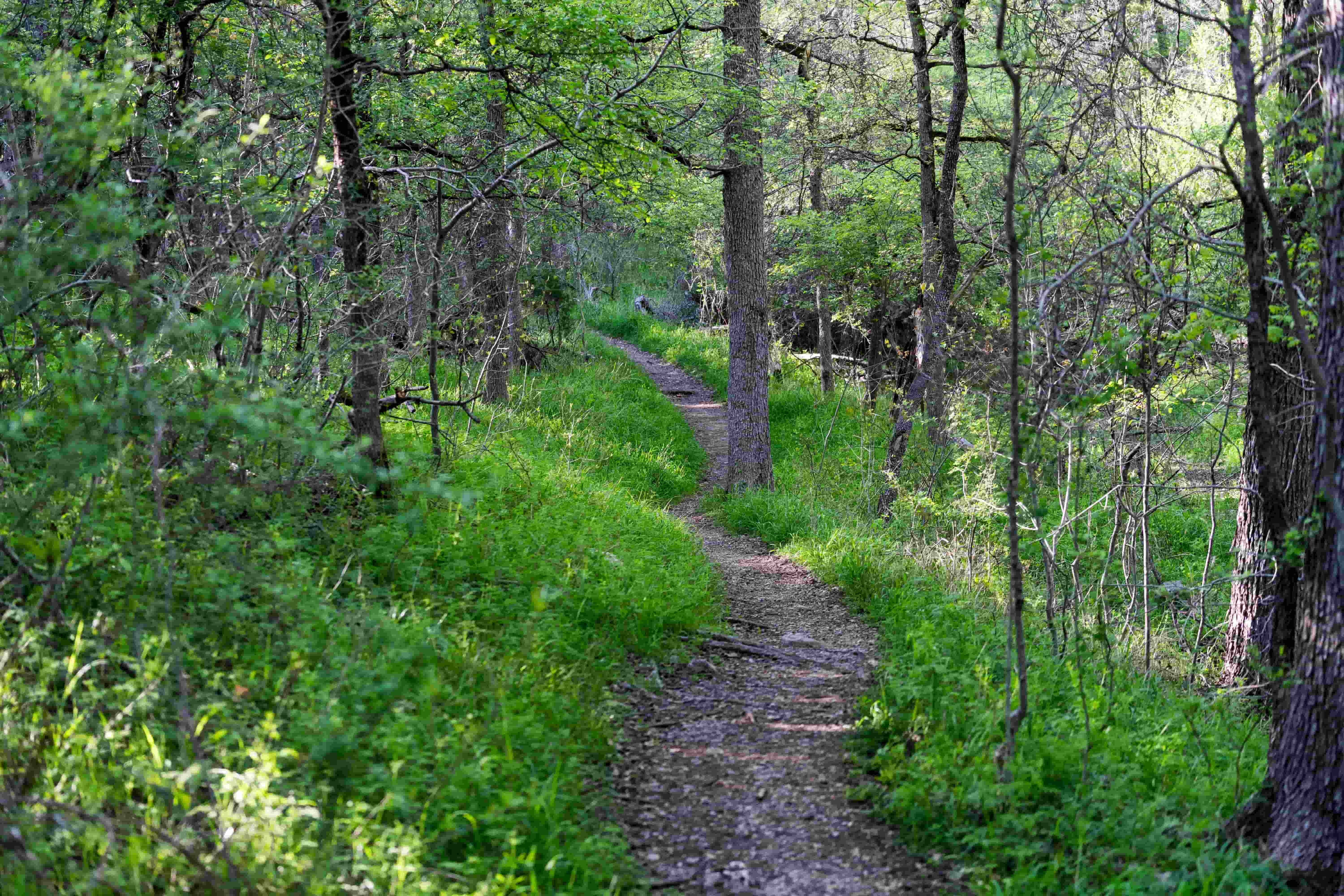
Now here’s what each one actually looks like when you show up.
Access Point Deep Dives
Zilker / Trail Head — 2212 William Barton Dr
This is the eastern start of the Greenbelt, right next to Barton Springs Pool in Zilker Park. It’s also where the Violet Crown Trail begins. The Mile Zero trailhead opened here in November 2025, and the two trails share the same path for about 4 miles before splitting.
Parking reality: The Zilker lots are large, paved, and the only formal parking infrastructure on the entire Greenbelt. Free on weekdays. $7 flat fee on weekends and holidays from March through September. That sounds fine until you realize the lot fills by 10 AM on any decent Saturday. If you’re arriving after that, you’re circling Stratford Drive hoping someone leaves.
The trail: Flat, wide, and shaded. The first mile or so is the most accessible stretch of the entire Greenbelt: good for strollers, dogs, people who just want a walk without scrambling over rocks. It’s also the busiest section. Weekends bring a steady stream of runners, cyclists, dog walkers, and people wandering over from Barton Springs.
Honest take: Best access point for first-timers or anyone who wants an easy outing with real amenities nearby (restrooms, water fountains, picnic areas). But if you’re looking for the Greenbelt’s wilder side (swimming holes, climbing walls, waterfalls), you’ll have to hike a ways from here to reach any of that.
Nearest apartments: Zilker and the Barton Springs Road corridor. Walkable or bikeable from most communities in 78703.
Spyglass — 1601 Spyglass Dr
Tucked behind a residential area at the end of Spyglass Drive, right where it dead-ends at Barton Skyway. You’ll see a trail sign at the cul-de-sac. And yes, Tacodeli is right there. Breakfast tacos before a hike is an Austin institution at this point.
Parking reality: Street parking only. Free, but you’re in a neighborhood. Maybe 15-20 spots on a good day along Spyglass and the side street. Don’t block driveways, don’t take the Tacodeli lot (that’s not trail parking, no matter what anyone tells you). Off-peak times, you’ll find a spot. Weekend mornings? Get there by 8:30 or you’re walking from two blocks away.
The trail: Starts relatively flat, then gently descends toward the creek. Five to ten minutes and you’re at the water. This is your quickest route to Campbell’s Hole, about a half-mile hike. You’ll also find natural limestone tubs and slides carved into the creek bed near the entrance. When the water’s flowing, these are like nature’s own wading pools.
Honest take: My favorite access point for swimming. Quick walk to Campbell’s Hole and The Flats, decent parking most of the time, and Tacodeli. The limestone tubs near the entrance are worth a stop even if you don’t hike far. Just don’t come here expecting solitude on a Saturday.
Nearest apartments: South Lamar corridor and Barton Hills. Multiple communities within a 5-minute drive, some within walking distance. I’ve placed a lot of renters in this area specifically because they wanted the Greenbelt as their backyard. It’s one of the most common requests I get from people relocating to Austin.
Barton Hills / Homedale — 2009 Homedale Dr
This one’s near Barton Hills Elementary School, in a residential neighborhood. It gives you access to the east side of the creek, which means a different angle on Campbell’s Hole than you’d get from Spyglass.
Parking reality: There’s a free parking lot at Barton Hills School Park, which is more than most Greenbelt trailheads can say. But “lot” is generous. It’s small, and on weekends you’ll still end up on the street. It’s a residential neighborhood either way. Be respectful, don’t block driveways, and keep your voice down early in the morning.
The trail: Moderate. You’ll descend toward the creek and can head north to Campbell’s Hole or explore the east bank trails that add to the Greenbelt’s total 12+ miles. These east-side trails are less traveled than the main path and worth exploring even when the creek is dry.
Honest take: Underrated. Most people skip Homedale because they don’t know about it. If your goal is Campbell’s Hole from the less crowded side, or you want the quieter east bank trails, this is the move. Just know there are no restrooms and no amenities. Bring everything you need.
Nearest apartments: Deep in the Barton Hills / 78704 neighborhood. South Lamar apartments are 5-10 minutes away.
Gus Fruh — 2632 Barton Hills Dr
Where Barton Hills Drive dead-ends at a gated entry. Look for the trailhead sign and bulletin board.
Parking reality: Street parking along Barton Hills Drive and nearby residential streets. Free, but a genuine scavenger hunt on weekends. This is one of the most popular trailheads with the least parking. Towing is enforced if you block driveways or hydrants. Arrive before 9 AM on weekends or have a backup plan.
The trail: Moderate descent via a rocky path and stone steps to the creek. About 5-10 minutes to reach the water. Wear real shoes — flip-flops won’t cut it here, especially if you plan to explore the climbing walls.
What you’ll find: The Gus Fruh Pool is the deepest swimming hole on the Greenbelt when the creek is flowing. Wide, calm, almost lake-like. There’s usually a rope swing. The limestone climbing walls here (including Urban Assault, the tallest wall on the Greenbelt at roughly 90 feet) are a draw for climbers from all over Austin.
Honest take: If you want to swim in the Greenbelt, this is the spot when water levels cooperate. The pool holds water better than Campbell’s Hole or The Flats. But parking is a real problem, and the descent is rocky enough that it’s not ideal for young kids or anyone with mobility concerns.
Nearest apartments: Barton Hills and the South Lamar corridor. Walking distance from parts of 78704. If you’re apartment hunting and swimming is a non-negotiable, this is the trailhead I tell people to visit before signing a lease. It’ll either seal the deal on the neighborhood or save you from unrealistic expectations about water levels.
Loop 360 (Main Access) — 3753 S Capital of TX Hwy
This is the one Google Maps sends everyone to. It’s on the northbound side of Loop 360 (Capital of Texas Highway), tucked into the edge of an office park parking lot. You’ll see the Austin Parks and Recreation sign when you pull in.
Parking reality: Free gravel lot shared with the office complex. Decent capacity but it fills by late morning on weekends. If the trail lot is full, there’s overflow parking in the office park on weekends when the businesses are closed. During the week? Don’t park in the office spots. You will get towed.
The trail: This is the central hub of the Greenbelt. From here you can head east (downstream) toward Gus Fruh and Zilker, or west (upstream) toward Twin Falls and Sculpture Falls. The entry path uses gently sloping switchbacks rather than a steep drop. Easier on the knees than Gus Fruh or Trail’s End. Wide, well-marked trail.
What you’ll find: This is mountain bike territory. The terrain gets more technical here, and you’ll see riders in full gear. Seismic Wall, one of the Greenbelt’s most popular climbing spots, is accessed from this section. The Violet Crown Trail splits off from the Greenbelt near here too.
Honest take: Overrated as a starting point for hikers and swimmers. The highway noise is real — you can hear Loop 360 traffic for a solid stretch of trail. Mountain bikers and climbers heading to Seismic? This is your trailhead. Everyone else? You’re better off starting at Spyglass, Gus Fruh, or Twin Falls and skipping the office park confusion.
Nearest apartments: Southwest Austin and the Oak Hill area. 5-10 minute drive from most communities along the 290/71 corridor.
Twin Falls / Gaines Creek — 3918 S MoPac Expy
On the MoPac (Loop 1) southbound frontage road, just south of Loop 360. This trailhead is sometimes called the Gaines Creek entrance. If you’re coming down MoPac southbound, take the Loop 360 exit, then continue straight on the service road. Trail parking is on the right.
Parking reality: Roadside shoulder parking along the frontage road. Free, but there’s no formal lot. You parallel park on gravel and hope for the best. Fills up fast on weekends by late morning. Do not park on the main highway. Only the service road.
The trail: Moderate. Initial descent is steep and rocky, then levels out along the creek. About 10-15 minutes of hiking to reach Twin Falls. Another 10-15 minutes past that to Sculpture Falls, roughly 1.2 miles total from the trailhead.
What you’ll find: The two biggest draws on the entire Greenbelt. Twin Falls is a double cascade over limestone ledges into a shallow pool. Good for photos and wading. Sculpture Falls is the main event: a larger waterfall with a deeper swimming pool. The water is creek-fed and cool but not constant like Barton Springs. It depends on recent rain and the season. This is where people come to actually swim.
Honest take: If waterfalls are why you’re here, start at Twin Falls. It’s the most direct route to both falls. The parking situation is the main downside: no lot, just a road shoulder. But it beats hiking 3+ miles from Zilker to reach the same spots.
Nearest apartments: South MoPac corridor and parts of Southwest Austin. Apartments in the 78745 ZIP code are generally 5-10 minutes away.
Trail’s End / Camp Craft — 1712 Camp Craft Rd
The western terminus of the Greenbelt, in the city of West Lake Hills near Westlake High School. Look for a small trailhead sign and gate on Camp Craft Road.
Parking reality: Street parking, and it’s paid. West Lake Hills enforces paid parking 8 AM to 8 PM daily via pay station or mobile app. Rates have been around $2/hour or $6/day, but check signage when you arrive since the city adjusts these. They do ticket. The upside? Paid parking keeps the crowds thinner than the free trailheads.
The trail: This is the Hill of Life. A 300-foot elevation drop in about half a mile of rocky, eroded jeep-road trail. Going down is hard on your knees. Coming back up is a genuine workout. Local runners and mountain bikers use it for training reps. Not recommended for young kids or anyone who didn’t come prepared for a steep hike.
What you’ll find: At the bottom of the Hill of Life, you enter the Barton Creek Wilderness Park, the most remote-feeling stretch of the Greenbelt. Sculpture Falls is accessible from this side too, though it’s a longer hike than from the Twin Falls trailhead. Wildflowers line the trail in spring.
Honest take: Only come here if you want the Hill of Life challenge or you specifically want to approach Sculpture Falls from the west. The paid parking is actually a benefit. It thins the crowd. But the trail difficulty is no joke. I’ve seen people turn around halfway down when they realize what the climb back up looks like.
Nearest apartments: West Austin and Rollingwood. Limited apartment inventory in Westlake proper. Most renters in this area are in higher-end communities with 1BR rents starting around $1,800.
Parking at a Glance
| Access Point | Type | Cost | Weekend Availability |
|---|---|---|---|
| Zilker / Trail Head | Paved lot | Free weekdays / $7 weekends (Mar–Sep) | Fills by 10 AM |
| Spyglass | Street | Free | Limited — arrive by 8:30 |
| Barton Hills / Homedale | School park lot | Free | Small lot + street overflow |
| Gus Fruh | Street | Free | Scavenger hunt — go early |
| Loop 360 | Shared lot | Free | Fills by late morning |
| Twin Falls / Gaines Creek | Roadside shoulder | Free | Fills fast, no lot |
| Trail’s End / Camp Craft | Street | Paid (8 AM–8 PM) | Usually available |
Spots Worth Visiting Along the Trail
The access points get you in. These are the places worth walking to.
Campbell’s Hole
Accessed from Spyglass (about 0.5 miles) or Barton Hills/Homedale (east side). Less packed than Barton Springs Pool, and free. The pool is shallow to waist-deep when the creek is flowing. It doesn’t hold water as well as Gus Fruh after dry spells. Good for wading and lounging on the rocks. Honestly? It’s better as a hangout spot than a swimming spot. Don’t come here expecting to dive in.
The Flats
A short walk from the Spyglass entrance, maybe 10-15 minutes. Flat, shady, creek-side lounging. This isn’t a deep swimming spot; think ankle-to-knee depth on a good day. But it’s one of the most relaxing spots on the trail. Bring a blanket and a book. If you’re not trying to “do” anything and just want to sit by water under shade, The Flats is the move.
Gus Fruh Pool
Down the trail from the Gus Fruh access point, you’ll reach it in under 10 minutes. When flowing, this is the deepest and most lake-like swimming hole on the Greenbelt. Rope swings, limestone walls on both sides, calm water. On a hot day after good rain, this place is packed for a reason.
Twin Falls
About a 10-15 minute hike from the Twin Falls/Gaines Creek trailhead. Two streams of water pouring over limestone ledges into a shallow pool. It’s scenic, great for photos, but the pool is usually too shallow for real swimming. More of a wading and photo spot. Worth seeing on your way to Sculpture Falls, just don’t make it the main event.
Sculpture Falls
The main event. Another 10-15 minutes past Twin Falls, about 1.2 miles total from the Twin Falls access. Larger waterfall, deeper pool. The water is creek-fed and cool but not spring-fed like Barton Springs, so temperature varies with the season and weather. This is where you come to actually swim. It’s also accessible from Trail’s End on the west side, though that’s a longer and harder hike. Worth every step.
Hill of Life
Not a destination so much as a rite of passage. Half a mile of steep switchbacks at the western end of the trail, dropping 300 feet of elevation. Mountain bikers and trail runners train on this thing by doing repeats. If you start at Trail’s End, you’re going down it first — which means you’re climbing it on the way out. Plan accordingly.
Climbing Walls (Quick Reference)
The Greenbelt has some of the best limestone climbing in Central Texas. The major walls, roughly east to west:
| Wall | Mile Marker (approx.) | Nearest Access | Level |
|---|---|---|---|
| Enclave | MM ~1.5 | Spyglass | Bouldering, moderate |
| New Wall / Great Wall | MM ~1.5 | Spyglass | Mixed |
| Guide’s Wall | MM ~2 | Gus Fruh | Beginner-friendly |
| Urban Assault | MM ~2.5 | Gus Fruh | Advanced — tallest wall (~90 ft) |
| Seismic Wall | MM ~3.5 | Loop 360 | Moderate — most popular |
If climbing is your thing, Mountain Project’s Barton Creek page has detailed route info and current conditions.
Swimming Holes & Falls — Quick Comparison
| Spot | Nearest Access Point | Hike Distance | Depth (when flowing) | Crowd Level |
|---|---|---|---|---|
| Campbell’s Hole | Spyglass or Barton Hills | ~0.5 mi from Spyglass | Waist-deep | Moderate |
| The Flats | Spyglass | ~0.3 mi | Ankle to knee | Light |
| Gus Fruh Pool | Gus Fruh | ~0.2 mi | Deep (6+ ft) | Moderate–Heavy |
| Twin Falls | Twin Falls / Gaines Creek | ~0.4 mi | Shallow wading | Heavy |
| Sculpture Falls | Twin Falls / Gaines Creek or Trail’s End | ~1.2 mi from Twin Falls access | Chest-deep | Moderate |
The Violet Crown Trail Connection
One thing most Greenbelt guides mention in passing but never actually explain: the Violet Crown Trail shares the Barton Creek Greenbelt path for about 4 miles before splitting off on its own.
The two trails start together at the Zilker/Trail Head entrance. The Mile Zero trailhead with its steel archway opened here in November 2025. You’re on the same path heading west until roughly the 4-mile marker, just past Loop 360, where a fork sends the Violet Crown Trail southwest through the Gaines Creek area toward Circle C Ranch and beyond. Phase 1 of the Violet Crown Trail is complete: 13 miles from Zilker Park to the Lady Bird Johnson Wildflower Center. Once the remaining phases are built, the trail will stretch roughly 30 miles into Hays County.
Why does this matter? If you’re a runner or long-distance hiker and 7.5 miles of Greenbelt isn’t enough, the Violet Crown extension gives you a much longer route without backtracking. And if you live in south Austin (Circle C, Shady Hollow, the Slaughter Lane corridor), the Violet Crown Trail gives you Greenbelt access from the south side without driving to Zilker or Loop 360.
Look for trail markers at the fork. The split is signed, but it’s easy to miss if you’re not paying attention.
When to Go: Seasonal Conditions and Water Levels
Here’s the thing nobody tells you about the Barton Creek Greenbelt: the swimming holes are dry more often than they’re full.
Barton Creek is rainfall-dependent. No rain for a few weeks? The creek bed turns into a rock garden. The swimming holes become empty limestone bowls. You’ll show up expecting Sculpture Falls and find a trickle over dry rock. I’ve watched renters move to Barton Hills specifically for Greenbelt swimming access, only to find out the creek’s been dry since June.
That doesn’t mean the Greenbelt isn’t worth visiting year-round. It absolutely is. Hiking, biking, climbing, and trail running don’t need water. But if swimming is the draw, you need to time it right.
Season-by-Season Breakdown
| Season | Creek Water? | Crowds | Typical Temps | Best Activities |
|---|---|---|---|---|
| Spring (Mar–May) | Usually flowing after winter/spring rains | Moderate–Heavy | 65–85°F | Swimming, hiking, climbing, wildflowers |
| Summer (Jun–Aug) | Often dry by mid-June unless wet year | Heavy mornings, light midday (too hot) | 90–105°F | Early AM hikes only — heat is serious |
| Fall (Sep–Nov) | Variable — fall rains can refill the creek | Light–Moderate | 70–90°F | Hiking, biking, climbing |
| Winter (Dec–Feb) | Variable — depends on fall/winter rainfall | Light | 40–65°F | Trail running, hiking, solitude |
Spring is the sweet spot. March through May typically brings enough rainfall to keep the creek flowing, temperatures are manageable, and the wildflowers along the trail, especially near Trail’s End, are worth the trip on their own. April and May get crowded, though. If you can go on a Tuesday morning in March, you’ll have the trail to yourself.
Summer is when people get disappointed. Texas heat is brutal on exposed trail sections, and the creek dries up fast when rain stops. If you’re going in July or August, start before 8 AM and stick to the shaded sections near Zilker or Spyglass. Don’t plan on swimming unless it’s been raining.
How to Check Water Levels Before You Go
Don’t drive out to the Greenbelt without checking first. Two free resources:
- USGS National Water Information System. The U.S. Geological Survey monitors Barton Creek water flow at Loop 360 in real time. If the gauge reads zero or near-zero cubic feet per second, the creek is dry. Above 10 cfs and you’ll find pooled water in the deeper holes. Above 50 cfs and the falls are flowing.
- LCRA Hydromet. The Lower Colorado River Authority tracks water conditions across the region, including Barton Creek gauges.
Bookmark one of those links. Check it the morning of. It takes 30 seconds and saves you from showing up to an empty creek bed with a cooler full of drinks and nowhere to swim.
A Note on Flash Floods
The flip side of “check for water” is “too much water.” Barton Creek runs through a narrow limestone canyon, and after heavy rain, water levels can rise fast — fast enough that the city has closed trail sections before. Flash flooding on Barton Creek is a real risk, not a hypothetical one. If there’s a flash flood watch or heavy storms in the forecast, stay off the trail. If you’re already on the trail and you see the water rising or hear a roar upstream, get to high ground immediately. Don’t try to cross a flooded creek bed. The same geology that makes the Greenbelt beautiful (steep canyon walls, narrow creek channel) makes it dangerous when the water comes up.
Greenbelt Access and Apartment Living: Which Neighborhoods Put You Closest
This is where my day job and the Greenbelt overlap.
I place renters in Austin apartments for a living. And one of the most common requests I get, especially from people relocating here, is “I want to be close to outdoor stuff.” The Greenbelt is usually what they mean. So I’ve spent years figuring out which apartment neighborhoods actually deliver on that promise and which ones just look close on a map.
Here’s how the Greenbelt corridor breaks down by rental area.
Barton Hills / 78704
Walking distance to three access points: Spyglass, Barton Hills/Homedale, and Gus Fruh. This is as close as you can get to the Greenbelt without literally living on the trail. The South Lamar corridor runs parallel, and most apartment communities along it are a 5-minute drive or a 10-15 minute walk to a trailhead. Rent for a 1BR typically runs $1,200–$1,900 depending on the community and how new the build is. South Lamar also puts you walking distance to dozens of restaurants, coffee shops, and bars, so you’re not just near the trail, you’re near everything.
Zilker / 78703
The Zilker Trail Head is the eastern anchor, and the surrounding neighborhood puts you within biking distance of both the Greenbelt and Barton Springs Pool. You’re also close to downtown. The trade-off is price. 1BR rents in the Zilker area generally run $1,400–$2,200. Older communities at the lower end, newer builds pushing higher. But the lifestyle trade-off is real. Zilker Festival, ACL, Barton Springs, and the Greenbelt are all basically in your front yard. (Zilker and South Lamar both rank high on our best Austin neighborhoods for young professionals list.)
Southwest Austin / Oak Hill / 78745
Loop 360 and Twin Falls access points are 5-10 minutes by car from most apartments in this area. You won’t walk to the trail from here, but you’ll drive less than most people assume. Rents are more affordable: 1BR in the $1,100–$1,600 range. A lot of renters land here when they want Greenbelt proximity without the Barton Hills price tag. The trade-off is that you’re further from downtown nightlife and dining, but if your weekends revolve around trails more than bars, that math works out.
Westlake / Rollingwood
Closest to Trail’s End and Camp Craft. Beautiful area, but apartment inventory is limited. Westlake is mostly single-family homes. The communities that do exist are higher-end, with 1BR rents starting around $1,800 and climbing. If you’re renting in this area, you’re paying a premium for the schools and the address as much as the trail access. The Hill Country views are nice, though, and having the quiet, less-crowded western end of the Greenbelt as your home trail is a genuine perk.
| Access Point | Closest Rental Area | Typical 1BR Range | How Close? |
|---|---|---|---|
| Zilker / Trail Head | Zilker / Barton Springs Rd (78703) | $1,400–$2,200 | Walk or bike |
| Spyglass | Barton Hills / South Lamar (78704) | $1,200–$1,900 | Walk or 5-min drive |
| Barton Hills / Homedale | Barton Hills / South Lamar (78704) | $1,200–$1,900 | Walk |
| Gus Fruh | Barton Hills / South Lamar (78704) | $1,200–$1,900 | Walk or 5-min drive |
| Loop 360 | Southwest Austin / Oak Hill (78745) | $1,100–$1,600 | 5–10 min drive |
| Twin Falls / Gaines Creek | South MoPac / SW Austin (78745) | $1,100–$1,600 | 5–10 min drive |
| Trail’s End / Camp Craft | Westlake / Rollingwood | $1,800–$2,800 | Walk or 5-min drive |
If trail access is a priority in your apartment search, that’s something I factor in when matching renters to communities. Text me at 512-865-4672 and I’ll send you options near the trailheads you care about.
What to Bring (And What Locals Know That You Don’t)
I can always tell when someone is hitting the Greenbelt for the first time. They show up in flip-flops with a half-empty Dasani from the gas station. Here’s what I actually bring, and what I tell every renter who asks about the trail.
Water. This is the big one. There are zero water fountains on the trail. Zilker Park has fountains near the trailhead, but once you’re on the Greenbelt, nothing. Bring at least a liter per person for a short hike, and double that in summer or if you’re going past Loop 360. A refillable bottle with a filter isn’t a bad idea if you’re doing the full trail. Dehydration on a 100-degree Austin afternoon is no joke — people get hauled out by EMS every summer.
Real shoes. Not sandals, not flip-flops, not fashion sneakers. The trail is rocky limestone. Gus Fruh and Trail’s End have steep, uneven descents. The creek bed rocks are slippery even when dry. Trail runners or hiking shoes with grip. If you’re planning to swim, bring water shoes for wading. The creek bottom will tear up bare feet.
Sun protection. Hat, sunscreen, sunglasses. The Zilker and Loop 360 sections have stretches with limited shade, and the reflected heat off the limestone is brutal in summer.
Bug spray. Mosquitoes pick up in spring and fall, especially near standing water. Chiggers are real from late spring through early fall. Stick to the trail and avoid sitting in tall grass.
Offline trail map. Cell service dies once you drop into the creek canyon. AllTrails lets you download the Barton Creek Greenbelt map for offline use. Do this before you leave the house, not in the parking lot.
A few things people forget: A small trash bag (there are no cans on the trail), a basic first aid kit (scrapes on limestone are common), a towel if you’re swimming, and snacks if you’re going past the 3-mile mark. Oh, and tell someone where you’re going and when you expect to be back. With no cell service, nobody’s going to know if you twist an ankle at Sculpture Falls.
Watch for wildlife. Snakes are a reality on the Greenbelt — copperheads and cottonmouths live along the creek. Keep your eyes on the trail, don’t step over logs without looking, and give them space if you see one. Poison ivy is common along the edges of the trail, especially near water. Learn to recognize it before you go. You’ll also see deer, armadillos, and the occasional fox, all harmless, all worth stopping for.
Trail Rules and Etiquette
The Greenbelt is managed by Austin Parks and Recreation, and the rules exist for a reason. The trail system is heavily used, and a few people ignoring the basics ruins it for everyone.
Hours: 5 AM to 10 PM daily, all access points. The city enforces park curfew. Don’t be on the trail after 10.
Dogs: Allowed, but must be on leash. This is enforced, and it’s not optional. Pick up after your dog. Bag it and carry it out. Trash cans are only at trailheads.
Bikes: Mountain bikes are allowed on the main Greenbelt trail. They are not allowed on side footpaths or hiking-only spurs. Yield to hikers. Call out “on your left” when passing. Some sections, especially west of Loop 360, have heavy bike traffic.
Right of way: Hikers yield to uphill traffic. Bikers yield to hikers. Stay right, pass left. No more than two people side by side on the trail.
Leave No Trace: Barton Creek Greenbelt was named a Leave No Trace Hot Spot in 2020. Pack out everything you bring in: food wrappers, cans, bottles. No glass containers anywhere on the trail. No alcohol. No fires. No overnight camping.
Cell service: Spotty to nonexistent in the creek canyon. Download an offline trail map before you leave the house.
Water: No fountains on the trail. Bring your own. See the “What to Bring” section above for specifics.
Barton Creek Greenbelt: Frequently Asked Questions
How many access points does Barton Creek Greenbelt have?
Seven official access points along the main 7.5-mile trail: Zilker/Trail Head, Spyglass, Barton Hills/Homedale, Gus Fruh, Loop 360, Twin Falls/Gaines Creek, and Trail’s End at Camp Craft Road. Each one drops you into a different section of the trail with different terrain, parking, and nearby features. The comparison table earlier in this guide breaks down all seven side by side.
Is Barton Creek Greenbelt dog-friendly?
Yes, dogs are allowed on all sections of the trail. But they must be on leash at all times. This isn’t a suggestion; Austin Parks and Recreation enforces it. Bring waste bags and pack out anything your dog leaves behind. Trash cans are only at trailheads, not along the trail itself. The Zilker/Trail Head entrance is the easiest for dogs because the path is flat and wide, with water fountains and restrooms nearby.
Can you swim in Barton Creek Greenbelt?
When there’s water, yes. The main swimming holes are Campbell’s Hole, Gus Fruh Pool, and Sculpture Falls. But Barton Creek is entirely rainfall-dependent. During dry stretches (common in summer and fall), the creek bed can be completely dry. There are no lifeguards, no maintained swimming areas, and conditions change fast after storms. Always check the USGS water gauge for Barton Creek before you go.
Is there water in the Greenbelt right now?
Check the USGS Barton Creek water monitor. It updates in real time. If the gauge reads near zero cubic feet per second, the creek is dry. Above 10 cfs you’ll find pooled water in the deeper holes like Gus Fruh. Above 50 cfs and the falls should be flowing. Spring (March–May) is the most reliable season for water. By mid-June in a dry year, most of the creek bed is empty.
How long is the Barton Creek Greenbelt trail?
The main trail runs about 7.5 miles from the Zilker/Trail Head entrance on the east end to Trail’s End at Camp Craft Road on the west end. The total trail network, including side trails, east bank paths, and connecting spurs, covers over 12 miles. A full end-to-end hike of the main trail takes roughly 3-4 hours one way depending on your pace and how many stops you make.
What is the easiest Barton Creek Greenbelt access point?
Zilker/Trail Head. Flat, wide path with no steep descents. Paved parking lot, restrooms, and water fountains at Zilker Park. It’s the only access point with real amenities at the trailhead. Loop 360 is a close second — the entry trail uses gentle switchbacks instead of a rocky descent. Avoid Trail’s End/Camp Craft if you want easy. The Hill of Life is a 300-foot drop that you’ll have to climb back up.
Is the Barton Creek Greenbelt free?
The trail itself is free. Parking costs vary by access point. Most trailheads have free street or lot parking. Two exceptions: Zilker charges $7 on weekends and holidays from March through September, and Trail’s End/Camp Craft has paid street parking enforced by the city of West Lake Hills from 8 AM to 8 PM. Check signage for current rates.
Can you mountain bike on the Barton Creek Greenbelt?
Yes, mountain biking is allowed on the main Greenbelt trail. It’s not allowed on side footpaths or hiking-only spurs. The terrain west of Loop 360 is the most popular section for mountain biking, with technical features that attract riders from across Austin. Loop 360 and Trail’s End are the two best access points for bikers. The Hill of Life at Trail’s End is a training ground for experienced riders.
What should I bring to the Barton Creek Greenbelt?
At minimum: a full water bottle (there are no fountains on the trail), sturdy shoes with grip, sunscreen, bug spray, and a downloaded offline trail map. If you’re swimming, add water shoes and a towel. If you’re going past the 3-mile mark, bring snacks. See the full “What to Bring” section above for the complete local rundown, including wildlife to watch for.
Which Greenbelt access point has the best parking?
Zilker/Trail Head has the only paved, formal parking lot — but it fills by 10 AM on weekends. Loop 360 has a shared gravel lot that’s decent capacity but also fills up. Trail’s End/Camp Craft has paid parking that’s usually available precisely because it costs money. For the neighborhood trailheads (Spyglass, Barton Hills, Gus Fruh), arrive before 9 AM on weekends or you’re circling residential streets. If parking stress isn’t your thing, text me at 512-865-4672. I can point you toward apartments close enough to walk or bike to the trailhead instead.
Pick the Right Trailhead, Not Just the Closest One
The Greenbelt isn’t one trail with one entrance. It’s seven different starting points that drop you into seven different experiences. Loop 360 is not the default, no matter what Google says.
The real variable is water. Check the USGS gauge before you drive out. If the creek is flowing, pick your access point by what you want to do: swim at Gus Fruh, chase waterfalls from Twin Falls, walk the dog at Zilker. If it’s dry, the hiking and climbing are still worth it, but adjust your expectations.
And if you’re apartment hunting in Austin and trail access actually matters to you — not just as a nice-to-have but as something you’ll use every week — where you sign a lease determines which trailhead is your trailhead. That’s something worth thinking about before you commit to a 12-month lease on the wrong side of town.
Looking for an apartment near the Barton Creek Greenbelt? I match renters to communities based on what actually matters to them: budget, commute, and yes, trail access. My locating service is free. The apartment pays me when you sign a lease. Get started here or text me at 512-865-4672.